
Gaines Township Neighbors: Block Sources
Public sources describe the block in layers. Parcel geometry shows which properties are near an address. A tax-roll record can show an owner and a mailing field. A hearing notice can identify recipients for one dated public proceeding. A criss-cross directory may show a household or phone clue for one historical edition. Those are not the same as a current block roster. The source and date decide what a result can support.
| Block source | What it can show | Access and caution |
|---|---|---|
| GIS parcels and address points | Adjacent parcel geometry, PPNs, situs fields, and public owner or mailing fields | Public viewer and query layer; county gives no warranty |
| Property Search | Tax-roll parcel, situs, owner, class, and value context | Public search with CAPTCHA; owner is not automatically an occupant |
| Zoning hearing notice | Owners assessed within 300 feet and occupants of structures within 300 feet for a proceeding | Event-specific notice, not a current block list |
| Voter sources | Individual status or a properly scoped current/election-specific file | Protected fields are excluded; date and geography matter |
| Criss-cross and street books | Dated address, household, and phone clues when an edition includes them | Library collections; year must travel with the result |
| Deed index | Recorded transfers for an adjoining parcel | Ownership record, not evidence of present occupancy |
Start with the parcel relationship, then state only what the chosen record actually returns. An owner may mail taxes from another city, one person may own adjoining parcels, and a nearby address can sit in a different school, precinct, postal, or utility area. The closest physical parcel is a map fact. Treating its owner as a current household needs a source-supported basis and still should not reveal or infer private household details.
Gaines Township Neighbors by Parcel Geometry
The Kent County Public Viewer supports address search and a parcel-map view. Locate the verified address, open its parcel, and inspect the parcels or address points around it. The more detailed county parcel layer supports map, data, and distance queries. Capture the target PPN or PNUM, the adjacent PPNs, property addresses, map extent or distance, query date, and source layer. That creates a reproducible block map without turning physical proximity into a claim about a relationship.
The viewer’s disclaimer matters. The county supplies its map as a research aid, not a warranty of ownership, boundary, or occupancy. Use a narrow map extent for an immediate block. A broad radius can cross a road, water feature, township edge, or service boundary that makes a straight-line result misleading. A whole-road question belongs in the Gaines Township street directory, which follows an address chain rather than a small surrounding area.
Gaines Township Parcel Address Fields
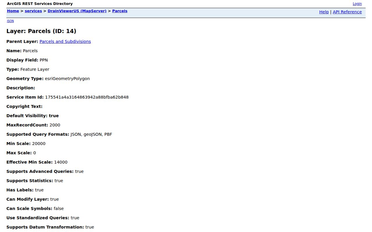
The county’s parcel layer keeps property and owner information in separate fields. Its public data includes PPN and PNUM, owner names, owner mailing address, property address, property class, government unit, school district, assessed values, house number, street, and geometry. That separation is an insider check worth making before following an adjoining parcel into the deed index. A mailing address can be formatted differently from the situs, can be located elsewhere, or can describe a tax contact rather than a household.
Kent’s GIS parcel-field listing shows the distinct owner and property fields used for this comparison.
For a second check, Kent Property Search can search an address or parcel number and offers the local-unit choice “20 - GAINES TOWNSHIP.” Its values are described as current as of March, with post-cycle changes processed in April. Use that timing as a reason to ask the assessor or Register of Deeds for an authoritative answer when the date is important.
Gaines Township Hearing Notice Radius
Gaines’ zoning ordinance supplies a useful but narrow public-neighborhood rule. For a public hearing, the ordinance describes notice to owners assessed within 300 feet and occupants of structures within 300 feet. That can help explain why a dated hearing file contains nearby addresses or names. It does not establish every current household, a social group, or a permanent radius around the parcel. Preserve the hearing date, parcel, and stated criterion with the result.
The Gaines zoning ordinance is the source for that 300-foot context. Match a notice list against parcel geometry only for the same proceeding. For maps, plats, aerials, or subdivision context, use the county’s public property-description and mapping route rather than guessing from an address list.
Note: A notice recipient is tied to a specific hearing and date, so label it as a proceeding record rather than a block roster.
Map Gaines Township Neighbors by Block
Use a compact process to keep a block search tied to the map rather than a name list. The starting address should first be normalized through the county address or parcel tools. The GIS map can then establish physical adjacency, while the property result supplies a tax-roll role and the deed index supplies a recorded-transfer role. Each step produces a different kind of evidence. Do not use a parcel owner as a shortcut to a current household identity.
- Search the verified address in the county parcel map and note its PPN or PNUM, situs address, and map date.
- Use the surrounding map extent or a distance query to record adjacent parcel identifiers and property addresses.
- Compare the public property result’s owner and mailing fields with its property address. Keep all three labels in the notes.
- When ownership needs confirmation, follow the parcel’s legal description or owner clue to the Register of Deeds index and then the proper copy route.
- For an old block, pair the same house number with the dated criss-cross or street-address edition before treating a household clue as historical evidence.
Parcel geometry, owner mailing relationship, and civic or service area are three different kinds of proximity. A single owner may hold several parcels, and a road may split addresses that look close on a small map. For a full named-street chain, use the Gaines Township street directory link above rather than extending a block map beyond the evidence it can support.
Gaines Township Neighbors and Civic Records
Civic sources give geographic context, not a casual block roster. The Michigan Voter Information Center can confirm an individual’s registration status, polling place, sample ballot, and related ballot information. Its live field labels were not fully captured in the research, so use the official current screen and do not promise a particular search field. Michigan voter-registration records are public through FOIA, but driver-license or state-ID numbers, month and day of birth, phone numbers, email addresses, and other protected details are excluded.
A broader record requires the Kent voter-file request form. It specifies a county, city, or township geography and may be limited by district, ward, precinct, or a particular election date. The county says a return can include complete name, residential address, and mailing address when available. Email delivery is used if possible, USB otherwise, and printing costs $0.10 per page. The form does not state a processing time, so ask Elections rather than assuming one.
Kent County’s Gaines Township page supplies current election context, including township precinct locations and the two 24/7 absentee-ballot boxes. Locations can change by election, so the page and MVIC should be checked again when the polling question is current.
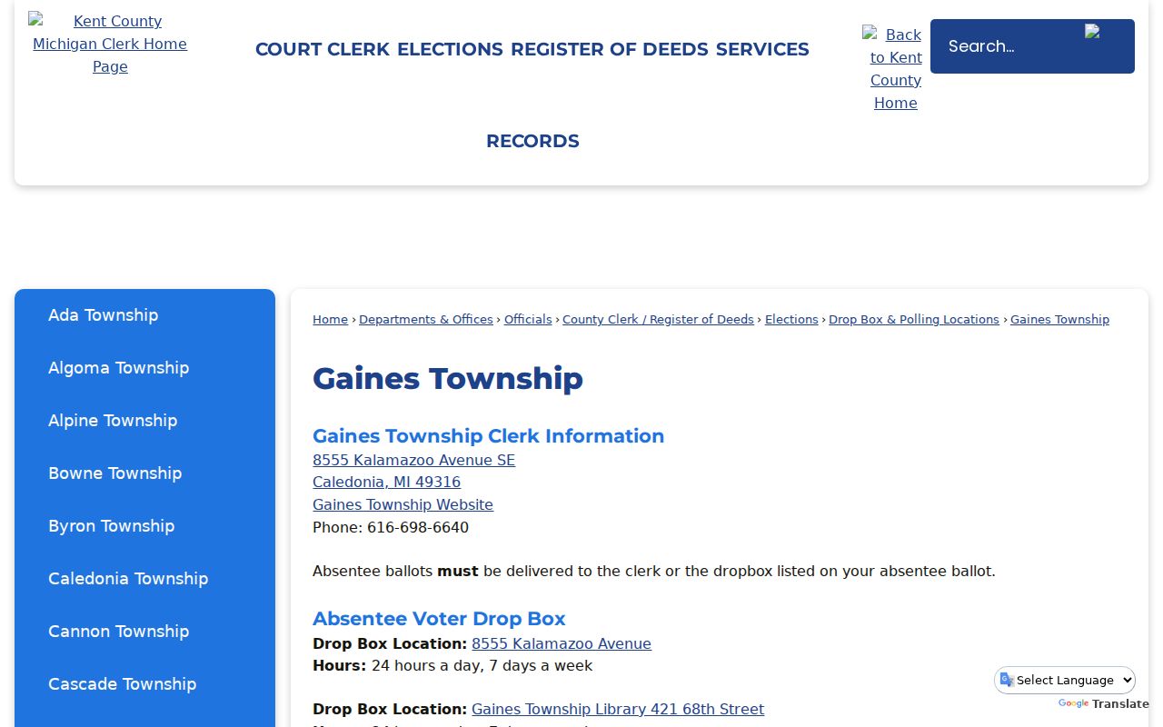
The precinct page helps distinguish a voting location from a residential block. A precinct, school district, postal city, and utility boundary can all cross or differ from the township line. Keep each geography labeled by its source instead of treating it as proof of who lives beside an address.
Gaines Township Neighbors in Dated Directories
Historic blocks need historic sources. Library of Congress finding aids identify Grand Rapids and Kent County criss-cross runs for 1946 and 1972–1996, plus Grand Rapids street-address volumes for 1955–1960. A criss-cross directory works in reverse: begin with the street and house number, then record the household or phone clue exactly as that edition presents it. Publisher practices vary, so a first-listed name or phone listing is not proof that every person at the address appeared in the book.
The Library of Congress criss-cross guide identifies those local runs. KDL’s Grand Rapids Press Historical Archives can add dated obituaries, notices, road matters, and civic references from 1893–1970, but the archive is available onsite at a KDL branch. A deed can show a transfer while a directory can show a household clue, and the timelines may reasonably differ.
For an old road description, preserve the wording rather than silently converting it to a current address. The 1870 Gaines material describes Old Gull Road as a zig-zag north-south route later straightened along section lines. Compare historical wording, later directory editions, and current GIS address points before connecting an older entry to a present parcel.
Gaines Township Community Leads
No official Gaines neighborhood-association directory was located in the research. That is a real gap, not permission to treat a subdivision name or a public map label as an association. Community research can still use public institutional contacts for a meeting, historic context, or a defined civic process. None of these contacts provides a resident roster, and no customer or private member list should be requested or published.
Gaines Township Clerk
The county Gaines page is the stable official route for township election infrastructure and clerk context. Ask the clerk about a specific township-held record, not for a resident list.
Gaines KDL Branch
The branch has public computers, free printing, Wi-Fi, and a local-history room. Its broader library resources can support dated news and genealogy research.
Kent Hearing Records
A public-hearing notice can give an event-bound map of nearby notice recipients. Keep the proceeding date and stated radius with any result.
This is also why official records are more useful than commercial directory categories for a narrow question. The comparison is not about completeness. It is about whether the source identifies its role, date, custodian, and correction path.
| Official record path | Commercial directory category |
|---|---|
| Names the custodian, map layer, hearing, or directory edition and supplies a source date. | May combine records with unclear dates or source roles. |
| Lets the reader verify a parcel, court, voter, or historical claim with the original office. | May not show enough provenance to check a match or correct an error. |
| Requires the reader to respect redactions and each record’s access boundary. | Should not replace a custodian record for a specific identity or address claim. |
Gaines Township Neighbor Privacy Checks
A parcel map cannot reveal every nearby household, and it should not be used to fill in missing household information. Property data identifies a tax-roll role, not necessarily an occupant. A voter file has protected fields. A public court result can omit protected categories. Utility customer information is not a block resource. When a source does not return a name or address, do not try to reconstruct it from adjoining records.
Michigan’s Address Confidentiality Program protects eligible people at risk through a designated substitute address and free mail forwarding. A visible address may be a substitute, old, mailing, or record-specific address. The program’s boundaries, together with redactions and separate vital-record eligibility rules, explain why a block record can be incomplete without being an error.
Lawful use. Use Gaines Township block records for personal research, civic context, or a defined property question. Never use a map, record, or address to watch, harass, intimidate, or repeatedly contact a person without consent.