
Search Gaines Township Streets
A Gaines Township street directory works best as a sequence, not as a roster. Begin with the street address in the county property system and capture the parcel identifier. Then compare that parcel in the GIS viewer, where the property address, owner mailing details, and map geometry are separate fields. Follow the tax-roll name into the recorded-deed index only after checking that the parcel and legal description agree. A voter request or dated criss-cross volume can add a different kind of evidence, but neither replaces the parcel or deed record. Each result needs its own date because ownership, mailing, election, and directory editions change on different schedules.
- Open the county property form, choose the Gaines local unit, and search the street number and name or a parcel number.
- Record the PPN or PNUM, situs address, class, and source date, then compare the result in the county GIS viewer.
- Check whether the owner mailing field differs from the property address. It is a tax-roll field, not a statement that the named owner lives at the parcel.
- Use the Kent deed index with grantor or grantee variants, recording dates, and the legal description to identify recorded transfers.
- For a dated household clue, compare the relevant address in library criss-cross volumes or request a voter file by township, precinct, or election date through the county form.
Start broad only long enough to normalize the address. The Property Search form accepts a street number, range, street name, and city/township/village selection. It also has Active Parcels selected by default and an Inactive Parcels option, which is useful for history but can produce records that are not active addresses. Its CAPTCHA blocks unattended bulk extraction. For Gaines Township, save the exact terms used rather than assuming the first spelling is the county’s normalized form.
Note: A parcel, a recorded transfer, and a dated directory entry serve different purposes and should remain separate in a Gaines research log.
Gaines Township Property Search Fields
Kent Property Search has an address route and a parcel route. In Gaines Township, the address form accepts Street Number, Range From, Range To, Street Name, and a City/Township/Village selector. The Gaines option is “20 - GAINES TOWNSHIP.” The parcel route fixes the county prefix at 41 and divides the remaining number into sections. County tips say to avoid punctuation, place a directional prefix before the street name, remove a street descriptor or directional suffix when needed, and try both “1st” and “First” for a numbered street. Values are noted as current as of March, with post-cycle changes processed in April.
The Kent Property Search screen shows the address controls, local-unit selection, active-status choices, and CAPTCHA used for a Gaines Township street directory search.
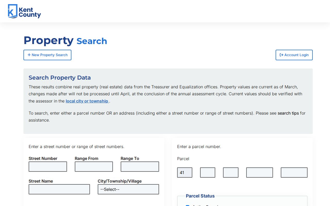
Use a narrow street range only after an individual result establishes the county’s street form. The search can provide parcel and tax-roll context, but a tax-roll name remains a lead for later verification through the assessor or Register of Deeds.
| Property Search Field | Entry Type | Gaines Street Use |
|---|---|---|
| Street Number | Numbers only, up to 10 characters | Find one situs address |
| Range From / Range To | Numeric range | Explore a bounded run of addresses |
| Street Name | Street text, up to 50 characters | Use county spelling and directional guidance |
| City/Township/Village | Local-unit selector | Select “20 - GAINES TOWNSHIP” |
| Active / Inactive | Status checkboxes | Keep inactive results for dated research only |
| Parcel number | Fixed 41 prefix plus segmented number | Confirm an exact parcel |
For Gaines Township property questions, the county directs searchers to Equalization or the local township assessor. The county mapping office also provides public-reference maps, aerials, and composite maps, with copies available in person, by email, phone, or fax.
Map Gaines Township Parcels by Street
The Gaines Township GIS viewer adds the map relationship that a street directory needs. Its parcel layer exposes PPN and PNUM, owner names, owner address and ZIP, property address and ZIP, property class, government unit, school district, SEV, taxable value, condo status, house number, street, and geometry. The group layer also contains parcels, subdivisions or condos, and address points. Address points carry an address, number, prefix, base name, and coded street type. The county allows map, query, and data operations, but notes that the map is supplied without warranty.
The Kent GIS Public Viewer is the address-search map used to place a returned parcel in its street context.

Map geometry can order parcels along a road or identify an adjoining parcel. It cannot establish a personal relationship, household membership, or current presence at an address. Large parcel queries also have a 2,000-record maximum, so a long Gaines Township street should be narrowed by extent, address range, or PPN.
- Parcel
- A mapped unit of land identified in county assessment records, commonly by PPN or PNUM.
- Situs address
- The property’s physical address field, distinct from the tax-roll owner’s mailing field.
- Plat
- A recorded subdivision map that helps locate lots, roads, and parcel layout.
- Criss-cross directory
- A dated reverse directory arranged by address rather than by a person’s name.
Note: School district, postal city, and parcel geometry can cross different boundaries, so none should be substituted for the Gaines Township local-unit result.
Compare Gaines Township Address Fields
In Gaines Township, the most useful street-directory check is often the difference between a mailing field and a situs field. The inspected GIS parcel layer keeps those fields apart. One sample row lists a Caledonia mailing address at 9255 Hanna Lake Ave while the property address is 9285 Hanna Lake Ave SE. Another normalizes a mailing form of Eastern SE to Eastern Ave SE. Such differences can reflect a tax owner who receives mail elsewhere, formatting, more than one parcel, or the timing of an update. They do not establish current occupancy.
The Kent GIS parcels layer makes the separate owner-mailing and property-address fields visible for an address comparison.
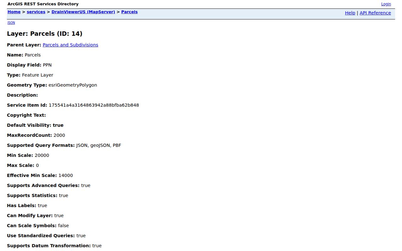
For a Gaines Township record log, keep both values with PPN or PNUM and the query date. Then use the property address for a postal check and the owner name or legal description for the deed search. That separation prevents a mailing ZIP from becoming an unsupported claim about the property or township residency.
Trace Gaines Township Street Deeds
The Register of Deeds supplies the recorded-land part of a Gaines Township street directory. Gaines Township title research begins with Kent’s basic online index, free from January 1, 1970 forward. Search a parcel owner or legal-description lead with spelling variants, then capture the grantor, grantee, instrument type, recording date, and instrument number. The index is a catalog-style pointer, not the recorded document itself. It can identify deeds, mortgages, land contracts, liens, releases, easements, and other instruments, but a party to a deed need not have lived at the parcel.
The Kent deed-search disclaimer shows the acceptance step and the county’s index-versus-record warning.
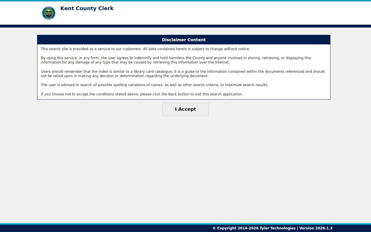
After June 22, 2026, online printed or downloaded images cost $1 per page by credit card, plus stated convenience or handling charges. A 24-hour advanced subscription is listed at $25 and a one-year option at $2,000, plus fees. If an image is needed, compare it with the index and retain only the recording facts necessary for the research question.
The Gaines Township in-person and written-copy route remains important. The Kent Register of Deeds is at 300 Monroe Ave NW in Grand Rapids, with copies requested in person or in writing when enough recording information is provided. Its office hours are Monday through Friday, 8:00 a.m. to 4:45 p.m.; recording closes at 4:30 p.m. For records before the online index, ask the office, historical volumes, or an archivist for the appropriate route.
Gaines Township Street Records Compared
Gaines Township address-keyed records form a useful chain only when each keeper’s role is clear. Property Search and the GIS map offer current tax and parcel context. The deed index points to recorded instruments. USPS normalizes delivery geography, and the geocoder can resolve a street string before it reaches the parcel map. A county voter-file request can return a current or election-specific record for the selected geography, while the individual voter tool is for status, polling place, sample ballot, and related confirmation. Neither postal nor voter information turns a property owner field into proof of present residence.
| Address Record | Keeper | Street Evidence | Access Channel |
|---|---|---|---|
| Property and tax roll | Kent Equalization/Treasurer | Parcel, situs, tax-roll owner, class, values | Online CAPTCHA search; assessor follow-up |
| GIS parcel and address points | Kent GIS | PPN/PNUM, geometry, mailing and property fields | Public viewer and REST layer |
| Recorded instruments | Kent Register of Deeds | Parties, dates, legal descriptions, document pointer | Free index, paid image, written or office copy |
| Postal validation | USPS | Address-based ZIP and postal city label | Address, city/state, or cities-by-ZIP modes |
| Voter data | Kent Elections / Michigan SOS | Registration or requested voter-file fields | MVIC or email/mail request form |
| Historic reverse directories | Library collections | Dated street and household clues | Library, microfilm, or onsite collection route |
The USPS ZIP Lookup has address, city-and-state, and cities-by-ZIP modes. Its own notice says a ZIP result does not confirm that a person or company is at an address. Kent’s Composite Street geocoder can supply a matched address, score, side, and address range for formatting work. Treat the match as an address aid, then verify the parcel.
Request Gaines Township Voter Records
Gaines Township voter sources answer a civic question rather than a parcel question. The Michigan Voter Information Center is the individual route for registration status, polling place, sample ballot, and related ballot information. Its current field labels were not fully captured in the research, so a Gaines Township street directory should not promise a particular name-and-address form. Michigan voter-registration records are public through the applicable rules, but they exclude driver-license or state-ID numbers, month and day of birth, phone, email, and other protected registration details.
The Kent voter-file request form is the fuller county route. It permits requests by county, city, or township with district, ward, precinct, and current-versus-specific-election choices. The county states that the file can include complete name, residential address, and mailing address if available. Submit it by email or mail; digital delivery is by email when possible, otherwise USB, and printed output costs $0.10 per page. The form does not state a processing time or an exact digital-delivery fee.
Log the requested Gaines Township geography, election date when used, file date, delivery format, and returned fields. A street address in a voter file is not a substitute for the parcel map, and an older election-specific result is not a current address record.
Read Gaines Township Street History
Gaines Township older street work needs dated sources. Library of Congress guides identify Grand Rapids street-address volumes from 1955 through 1960 and Kent County or Grand Rapids criss-cross volumes for 1946 and 1972 through 1996. These volumes may show a house number, street, first-listed household name, telephone, or an owner or occupant notation depending on the publisher. The Library of Michigan warns that formats vary, and a head-of-household convention can leave others out. A historical directory is evidence for its own edition year, not a current roster.
A state library finding aid explains Polk, street-address, criss-cross, microfilm, and online finding routes. Once a date and house number are established, the Gaines Township city directories provide the collection-focused historical path. The onsite Grand Rapids Press archive covers 1893 through 1970 and can help place a directory change beside an obituary, road notice, or property item.
For still earlier wording, the 1870 Kent County directory describes Gaines through sections, roads, settlement, and post-office relationships. Old Gull Road was later straightened along section lines. Preserve the old description beside a modern address or legal description rather than silently converting it into a modern house number.
Check Gaines Township Street Sources
Gaines Township’s BS&A service entry is a municipal lead for property, tax, utility, permit, and assessing services. Its live search fields were not inspectable during research because of access restrictions. It should not be treated as a confirmed public street roster or as proof that a particular record is available. Use it to identify the proper township service, then confirm the request route with the clerk or department.
The available BS&A service screen documents the service landing page rather than a verified record result.
When a Gaines Township address record is absent online, the fallback is a focused request. Kent County FOIA lists online, mail, fax, and hand-delivery channels. Name the department, date range, address, parcel or case identifier, and desired delivery format. The county describes a five-business-day response period, a possible ten-business-day extension, actual-cost fees, redaction, inspection during normal hours, and appeal rights. A written request is safer than a verbal request.
Note: A request should seek a describable non-exempt record from its custodian, not a generalized list of people associated with a street.
Protect Gaines Township Street Results
A Gaines Township street directory cannot identify every person connected with an address. Gaines Township parcel fields show tax and land information. Deeds show recorded parties and legal succession. A voter source has its own public-field limits, and a postal result identifies delivery geography. Michigan’s Address Confidentiality Program can also use a substitute address for eligible participants, so a difference, omission, or redaction can reflect a lawful protection rather than an error. Vital-record rules and protected court categories create other gaps that should not be reconstructed.
Michigan’s address-confidentiality program explains the substitute-address process, while the Michigan stalking statute defines related conduct. Keep a compact research record with the source URL, date, parcel or instrument identifier, and the limited fact each record actually supports. Confirm a disputed address with the assessor, Register of Deeds, township clerk, USPS, or other custodian instead of publishing a guess.