
Gaines Township ZIP Code Coverage
Six postal ZIP codes are identified as serving Gaines addresses: 49315, 49316, 49348, 49508, 49512, and 49548. They are working coverage labels, not official township subdivisions. A ZIP can extend outside Gaines, while a Gaines parcel can carry a postal city other than Gaines Township. The research did not locate an official polygon table assigning every road segment to a ZIP. Use this ZIP code directory as an address-by-address starting point, then let the United States Postal Service decide the delivery label for a specific location.
| ZIP | Areas Covered | Post Office | Notes |
|---|---|---|---|
| 49315 | Western and southwestern Gaines edge | Byron Center postal label | Verify each address; the ZIP extends beyond the township |
| 49316 | Eastern and southeastern Gaines edge | Caledonia postal label | Postal city is not the township name |
| 49348 | Southwestern rural edge | Wayland postal label | Verify the exact county and township connection |
| 49508 | North and northeastern suburban portion | Grand Rapids postal label | Approximate association only |
| 49512 | East and southeast side near airport postal geography | Grand Rapids postal label | Approximate association only |
| 49548 | Central and northwestern portion, including Gaines Library address | Grand Rapids postal label | USPS confirmation remains necessary |
Every row is approximate, USPS lookup required, and no official neighborhood-boundary table was located. The table supports postal navigation only. It should not be used to infer a precise neighborhood, full township coverage, or the current presence of a person at any address.
Note: A ZIP result answers a delivery question, while a parcel record and township source answer separate land and civic questions.
Verify Gaines Township Postal Labels
Gaines Township is a charter township in Kent County, while postal addresses can use Byron Center, Caledonia, Wayland, or Grand Rapids labels. That difference is expected. The Census boundary source identifies Gaines as Kent County subdivision FIPS 2608131240, and the township has about 35.7 square miles. Postal systems, tax units, census boundaries, school districts, and map layers each have their own purpose. A Grand Rapids label does not by itself put an address outside Gaines, and a nearby postal label does not alone put an address inside Gaines.
The practical sequence is three checks: USPS for delivery, GIS or Property Search for the parcel, and a township or county source for civic jurisdiction. If they do not line up, preserve the mismatch. The conflict may be useful evidence of different administrative systems, not a data error. The Census TIGER boundary source supplies the governmental boundary reference; it does not assign a postal ZIP to every property.
Search Gaines Township ZIP Codes
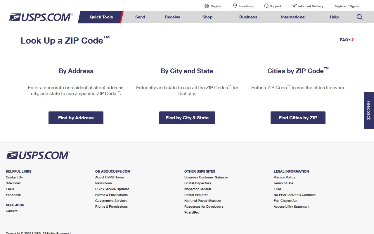
The official USPS ZIP Code Lookup has three useful workflows. Address lookup requires Street Address, City, and State, with optional company, apartment or suite, and known ZIP details. City-and-state lookup provides postal results from those place inputs. Cities-by-ZIP begins with a ZIP code instead. Use the full-address route whenever possible because it gives the most specific delivery check. USPS cautions that a returned ZIP does not confirm that a person or company is located at the address.
The USPS address-to-ZIP form is the official postal screen used for an individual Gaines Township ZIP code check.
Save the source date, full address submitted, returned city label, state, and ZIP. Do not replace a verified postal label with a preferred place name. If the address is incomplete, use the county geocoder to resolve the street form first, then return to USPS for the delivery result.
- ZIP code
- A postal delivery code, not a township or neighborhood boundary.
- ZIP+4
- An added delivery segment that refines routing within a ZIP code.
- PO-box ZIP
- A ZIP assigned for post-office box delivery and not evidence of a street location.
- Unique ZIP
- A ZIP used for a particular organization or delivery arrangement; none is identified for Gaines in the research.
- Carrier route
- A postal delivery grouping that may cross civic or parcel boundaries.
Gaines Township ZIP Code Search Fields
No inspected Gaines-wide property portal offered a verified ZIP-only filter. Instead, use the ZIP code to verify a complete address, then search the address in Kent Property Search or search its parcel number. Property Search accepts Street Number, Range From, Range To, Street Name, and City/Township/Village. The local-unit menu includes “20 - GAINES TOWNSHIP,” and Active Parcels is selected by default. The portal includes an Inactive Parcels option and a CAPTCHA. This is an address and parcel workflow, not a ZIP roster.
The Kent Property Search screen displays the fields available for the address step after a Gaines Township ZIP code has been verified.
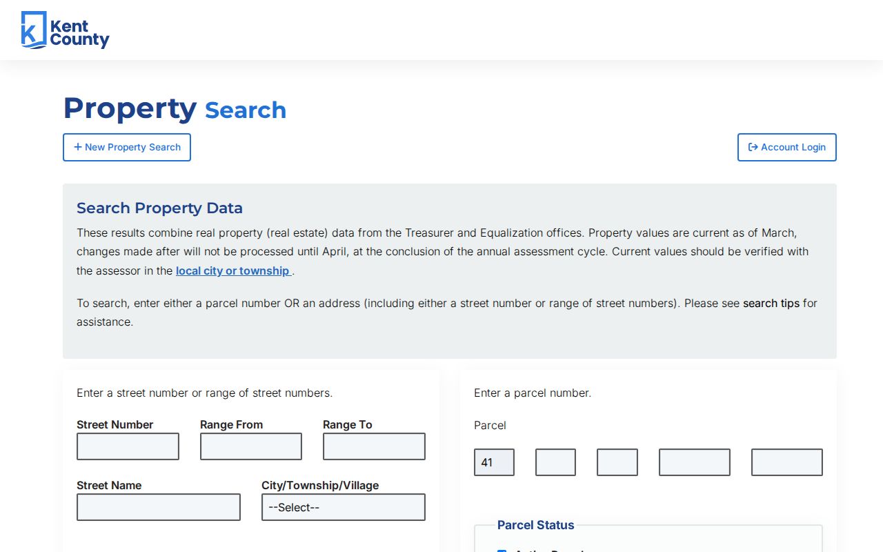
Search tips recommend avoiding punctuation, placing a directional prefix before a street name, removing a directional suffix or street descriptor when necessary, and testing “1st” and “First” for a numbered street. The form’s parcel search uses a fixed 41 county prefix and separate number segments. These controls help match a postal address to land records when the same road is formatted differently across sources.
| Portal Field | Type | ZIP Code Research Use |
|---|---|---|
| Street Number | Numbers only, maximum 10 characters | Anchor a USPS-verified address |
| Range From / Range To | Numeric range | Review a bounded address run after normalization |
| Street Name | Text, maximum 50 characters | Match the county’s street form |
| City/Township/Village | Local-unit selection | Select “20 - GAINES TOWNSHIP” |
| Active / Inactive | Status checkboxes | Separate current parcel work from history |
| Parcel number | 41 prefix and segmented parcel components | Confirm the parcel after address matching |
Compare Gaines Township Parcel ZIP Fields
Kent GIS keeps the property ZIP and owner ZIP in different fields. The parcel layer includes PPN, PNUM, owner names, owner address and ZIP, property address, Property State Zip Code, class, government unit, school district, SEV, taxable value, house number, street, and geometry. The owner’s mail ZIP can be outside Gaines or even outside the delivery area for the property. Use the property-address ZIP for the parcel comparison, and retain the owner mailing ZIP only as a tax-roll contact field.
The Kent GIS parcel-field view shows why mailing and property ZIP fields require separate treatment.
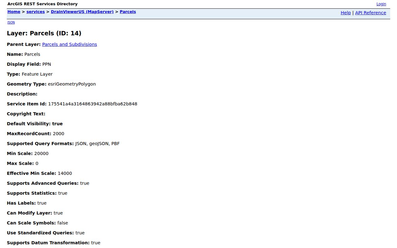
For example, an inspected row combines a Caledonia mailing address at 9255 Hanna Lake Ave with a property address at 9285 Hanna Lake Ave SE. The discrepancy could reflect a tax owner, multiple parcels, or a data update. It does not identify who currently uses the property. The public Kent GIS Public Viewer can map the address, while the REST layer allows queries and map/data operations subject to a 2,000-record maximum.
Note: Record the PPN or PNUM, property address, property ZIP, owner mailing ZIP, query date, and source layer before comparing any ZIP result.
Find Gaines Township Residents by ZIP
A ZIP code can narrow a research log, but the inspected public sources do not support a Gaines-wide ZIP-only resident list. Begin with a full address verified by USPS. Search the same address or PPN in Property Search and GIS. If a civic record is needed, use the source designed for it. Michigan’s Voter Information Center is an individual status, polling-place, sample-ballot, and related confirmation tool. Its exact live field labels were not fully captured in research, so no unverified field list should be promised.
- Enter the complete address in USPS and retain the returned postal city and ZIP with the search date.
- Normalize the address with Kent’s Composite Street geocoder if its spelling, direction, or street type differs from the postal result.
- Search Kent Property Search using the street and “20 - GAINES TOWNSHIP,” then record PPN or PNUM and the property ZIP from GIS.
- For a voter-file question, use the Kent voter-file request form for county, city, or township geography and district, ward, precinct, or election-date options.
- Compare only the source roles that answer the question. A postal label, parcel owner field, and voter record should remain distinct.
The voter-file form can request all current registered voters or voters for a specific election and may include complete name, residential address, and mailing address if available. It is delivered by email when possible, otherwise USB; printing is $0.10 per page. The form does not state a processing time or an exact digital-delivery fee. The requested geography is county, city, or township rather than ZIP, so do not describe it as a ZIP filter. Once an address is narrowed, the Gaines Township street directory supplies the full parcel-and-deed sequence.
Gaines Township Postal Boundary Gaps
The main ZIP code directory misconception is treating a postal label as a township line. The six working ZIP associations point toward Byron Center, Caledonia, Wayland, and Grand Rapids postal geography, but each can cross beyond Gaines. A single road can need an address-level check, and the owner’s mailing ZIP can differ from the property ZIP. The county geocoder returns Match_addr, score, side, and from-to address ranges; use it to resolve an address string, not to identify a person or declare a civic boundary.
Postal labels also change the way a search is written. Try the USPS-returned city label first, then the county’s local-unit selection and parcel map. When a result still conflicts, rely on the custodian associated with the question: USPS for delivery, Kent GIS and Equalization for parcel context, and township or county staff for jurisdiction. A Kent County FOIA request is the fallback for a describable non-exempt county record that is not online. The county lists online, mail, fax, and hand-delivery channels, a five-business-day response framework, possible extensions, actual-cost fees, inspection, and appeal rights.
Read Gaines Township Historic Addresses
A historic Gaines address may be a section, a road description, a settlement, or a post-office relationship rather than a modern ZIP code. The 1870 Kent directory places Gaines at town 5 north, range 11 west and describes Old Gull Road as a zig-zag route later straightened along section lines. A deed can use a legal description instead of a postal street address. Preserve the old wording, compare later maps and directories, and then connect it to a modern parcel only where the evidence supports that match.
The 1870 Kent County directory is a free historical starting point. Library of Congress guides identify street-address volumes for 1955 through 1960 and criss-cross runs for 1946 and 1972 through 1996. Those dated sources can help bridge an old description to a later street form, but neither should be converted into a current address without a parcel or legal-description check.
Limit Gaines Township ZIP Code Claims
ZIP code results should be used with restraint. USPS says the returned ZIP does not verify a person or company at an address. GIS parcel fields identify a land and tax-record relationship, not a current household. A recorded deed identifies parties and dates, not necessarily occupancy. Michigan’s Address Confidentiality Program can use substitute addresses for eligible participants, and other custodians may lawfully redact information. An omission or mismatch is not permission to reconstruct protected details from scattered sources.
Michigan’s Address Confidentiality Program describes its substitute-address protection. The Michigan stalking statute covers repeated unconsented contact and related conduct. Keep only the source URL, search date, address form, postal result, parcel identifier, and the limited conclusion the custodian’s record supports. For a disputed ZIP or civic boundary, ask USPS, Kent GIS, Equalization, or the township clerk to confirm the appropriate record.